
Chapter 1 - NetCOLOR: Societal benefits and rationale
Spaceborne remote sensing of the “colour” of water in oceans and lakes (often referred to as ocean colour radiometry, or OCR) is a very powerful tool, providing recurrent measurements of global phytoplankton biomass at synoptic scales, as well as derived inherent optical properties of other key water constituents. Given the size of Canada's ocean environment, which includes the world's longest coastline bordering three major oceans (Pacific, Atlantic, and Arctic), as well as its vast freshwater resources, it is crucial to be able to monitor the water quality, biological activity and the bulk biogeochemical state in these aquatic systems.
There are many applications of the data acquired by aquatic colour spaceborne sensors, both in research and operational arenas, with many important societal and economic benefits that can further our understanding of the environment and the anthropic forcing, including: pollution, climate change, resource assessment (including commercial and recreational fisheries), and degradation of these resources, allowing for better environmental management, strategic planning, and sustainable exploitation of the ocean.
Phytoplankton are the “primary producers” in oceans and lakes, and form the basis of the aquatic food web. They act as a food source for animals over a large range of trophic levels, from microscopic zooplankton to small fish and invertebrates (including benthic organisms and shellfish), up to multi-ton whales. Another vitally important role of phytoplankton is that they consume carbon dioxide (CO2) through the process of photosynthesis, and release oxygen into the atmosphere. The amount of CO2 consumed by phytoplankton each year is on a scale equivalent to that of forests and land plants. They release half-of the oxygen present in the atmosphere. By taking up CO2 and producing dimethyl sulfide (a gas involved in cloud formation and synthetized by some phytoplankton), phytoplankton play an important role in regulating our climate and weather patterns.
When phytoplankton die and sink, carbon contained in their skeletons is sequestered into the deep ocean. This process, often referred to as the “biological carbon pump”, transfers approximately 5 - 15 GT of carbon each year from the surface ocean to deep sea waters. Since more than 30% of all our CO2 emissions end up in the ocean, phytoplankton metabolism can therefore potentially reduce human-induced CO2 emissions in the atmosphere through carbon fixation. Continual monitoring of the concentration and composition of phytoplankton assemblages is essential in climate change studies.
Inland water systems are known to play a significant role in the global carbon budget as well. However, future changes to northern environments could alter these dynamics leading to either net carbon emission or sequestration. Canada's boreal forest biome is vast and contains a very high density of lakes, making this region challenging for long term monitoring. There is increasing evidence that boreal lakes are actively processing, emitting, and storing carbon. Yet, available estimates of carbon budget, pools and fluxes are missing for the vast majority of lakes across northern environments. Accordingly, long-term, system-wide approaches are required to accurately evaluate the importance of lakes for boreal carbon budgets in a changing environment. Satellite OCR appears to be the only tool capable of providing such a large-scale assessment. In fact, lake color is largely driven by the content of dissolved organic carbon, which can be assessed from space.
A major concern, from a Canadian perspective, is the water quality of inland and coastal waters, which are exposed to increasing external pressures resulting from climate change (e.g., increase in eutrophication and harmful algal bloom) and direct human activities e.g., agricultural, domestic and industrial pollutants, invasive species, tourism industry, intensive fishing and farming of aquatic organisms as well as increased greenhouse gases in the atmosphere. These pressures may act concurrently to reduce water quality and contribute to the deterioration of ecosystem health and its capacity to provide ecosystem services, such as supporting commercial fish stocks.
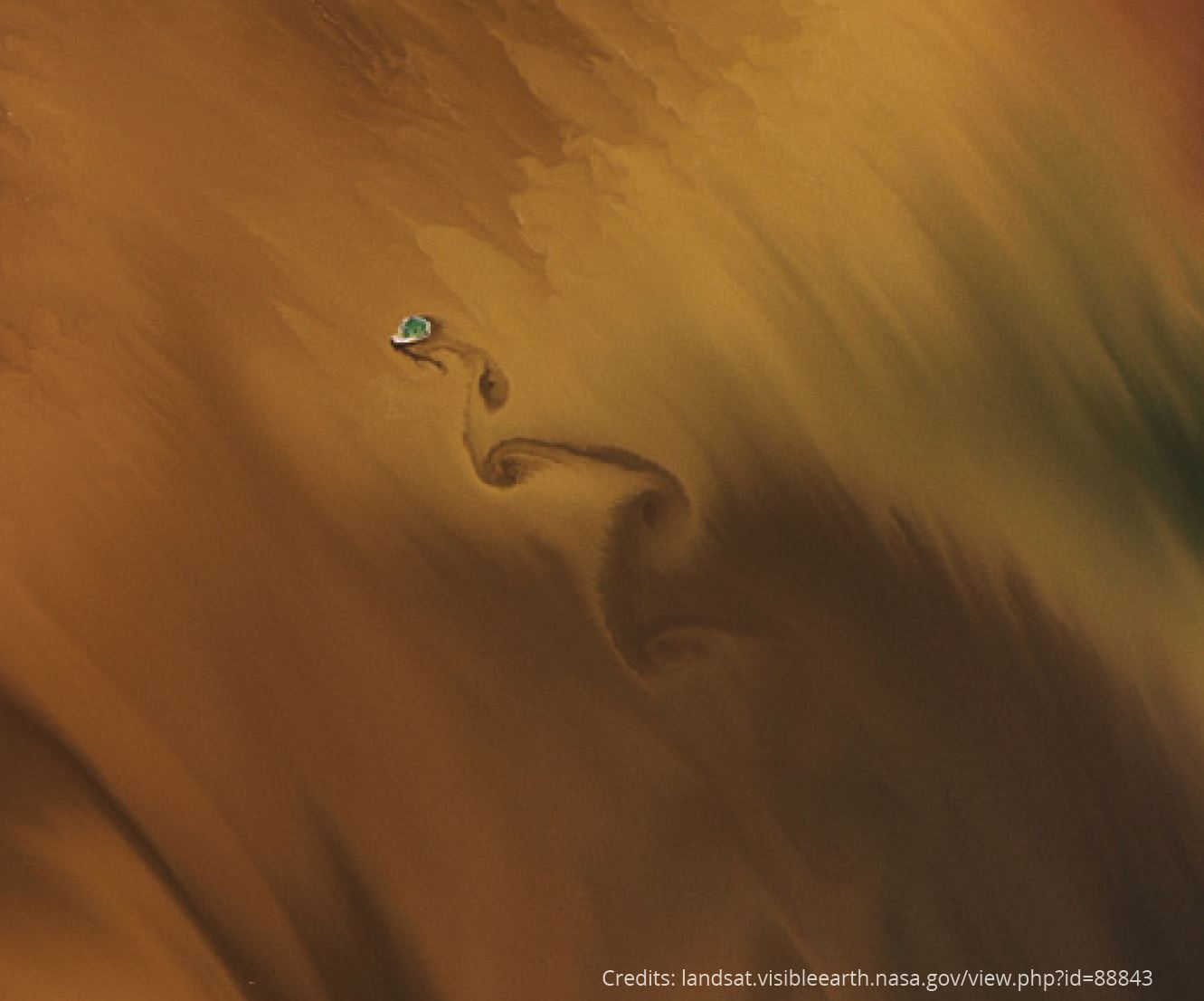
Assessments of ″water quality″ usually employed in situ techniques, which are time consuming, costly and have limited spatial coverage. Spaceborne remote sensing, on the other hand, is particularly useful for monitoring changes in water properties with frequent, synoptic coverage, and many operational aquatic-colour products can be used directly as Credits: NASA Earth Observatory water quality indicators. For example, spaceborne sensor estimates of light attenuation can be related to water transparency, which is used to assess and classify lakes and coastal waters. In addition, operational colour products in combination with data from different platforms, can transform this information into operational water quality maps.
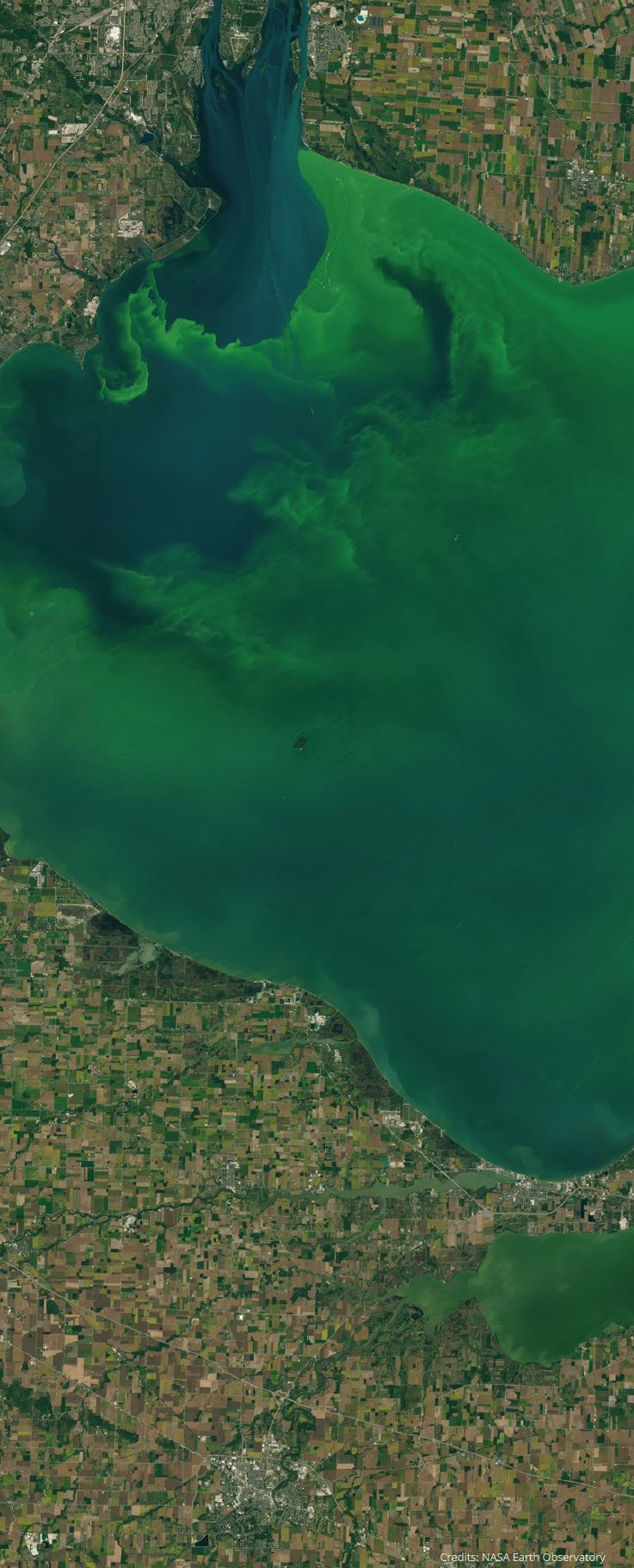
Eutrophication (the enrichment of water by nutrients leading to intense algal growth) is a widespread environmental threat to lakes, coastal waters and estuaries in Canada. Monitoring programs sample a set of parameters, including chlorophyll-a (an index of phytoplankton biomass), suspended particulate matter, turbidity, and phytoplankton composition, which are readily obtained from remotely-sensed data. These data, when coupled with in situ observations, provide eutrophication-indicator maps on a routine basis.
Eutrophic systems are often associated with harmful or nuisance algal blooms (HNABs) that can have deleterious impacts on ecosystems through massive production of biomass, resulting in anoxia (i.e., oxygen depleted waters) and mortality of marine and freshwater life. Some species of HNABs may cause fish kills and contaminate shellfish, even at low concentrations, through production of toxins, which can also seriously affect human health. Overall, HNABs can have a significant local economic impact, engendering losses in revenue from tourism, fish kills, and disruption of aquaculture industries and drinking water treatment facilities. Ocean-colour radiometry can play an important role in effective ecosystem management with regard to HNABs: routinely-acquired synoptic data relating to phytoplankton dynamics allow both a greater understanding of the variability of HNABs as ecologically-prominent phenomena, and a means of detecting and monitoring the extent and progression of these blooms in near-real time. Appropriate action can then be taken, such as issuing warnings to the aquaculture industry or communities relying on freshwater for drinking or leisure activities.
One of the advanced applications of spaceborne aquatic-colour data is the detection and quantification of suspended sediments and the observation of changes in bottom topography caused by sediment transport. This is particularly relevant in tidal estuaries and bays in Canada, which experience some of the highest tides in the world, and are often used for tidal power schemes. Active sediment transport can impact tidal energy production, can also alter the course of, or reduce the depth of, shipping channels and ports.
Chapter 2 - NetCOLOR priorities
The international optical aquatic science community has been a driving force for Earth observation (EO) over the last four decades. Among this large community, several Canadian scientists are forerunners, laying the path for the development of new instrumentation, innovative algorithms, and spaceborne applications for marine and freshwater issues. Between 1975 and 2015, eight Canadian members of this community produced 518 peer-reviewed articles, or more than 10 articles per year. These articles have been cited 22,700 times at-testing to the important contribution of Canada to the current state of aquatic optical remote sensing 1.
Remote sensing of lakes and oceans has seen tremendous improvement since the launch of the first “ocean-colour” sensor by NASA in 1979 (Coastal Zone Color Scanner). While several ocean-colour multispectral sensors are currently in orbit (VIIRS, MODIS, OLCI and SGLI), the scope of spaceborne applications has broadened with the use of very-high spatial, broad-band sensors (e.g., Landsat, SPOT, Sentinel-2 MSI) and the future generation of hyperspectral sensors (e.g., PACE).
The Canadian aquatic colour community remains active and engaged and has arrived at a turning point with the responsibility of building on the legacy built over the last forty years. The need for a national strategy and long-term vision has unified our community under the leadership of NetCOLOR (Network of Coastal, Oceans, and Lakes Optics Remote sensing). The current document aims at addressing the future directions and objectives of the Canadian aquatic colour community to tackle issues related to the understanding, monitoring, and protection of our freshwater, estuarine, and marine environments, as well as bridging the gap with end-users to ensure that the most appropriate space- and air-borne products are available to help management make science-based decisions. A wide range of products can be derived from visible spectral radiometry. Participants at a NetCOLOR meeting that took place in Québec City in March 2016 reviewed the state-of-the-art advancement in the field of aquatic colour at the international level and selected the 10 most pressing issues relevant to Canada's interests in monitoring and protecting its lake, coastal, and ocean environments. Note that the order of the 10 issues listed below does not reflect their priorities.
2.1 Ecosystem shifts in a changing climate
Phytoplankton sustain aquatic life in oceans and lakes and changes to their abundance, rates of production, and species composition may have irreversible impacts on food webs, and ultimate-ly on human economical activities. Shifts in the timing, duration, magnitude and composition of phytoplankton blooms can have significant impacts on aquatic ecosystem functioning. Such changes to marine spring phytoplankton bloom shape the higher trophic levels over the course of several years, since it has been shown to have an impact on larval fish recruitment of several commercially important fish species. Given that the properties of phytoplankton blooms vary significantly at the regional scale, only satellite ocean colour radiometry can resolve the spatial and temporal variability at the synoptic scales needed to characterise them accurately.
Several studies have demonstrated the link between the phytoplankton spring bloom and re-cruitment of fish and benthic organisms as well as breeding success of marine birds in several areas of Canada's three major oceans, including the Pacific (Malick et al., 2015, Borstadt et al., 2011) and the Atlantic (Platt et al., 2003, Trzcinski et al., 2013). Under warming climate conditions, the phytoplankton spring bloom tends to occur earlier in the Arctic (Kharu et al., 2010; Marchese et al., 2017), while a second bloom is developing in the fall (Ardyna et al., 2014). The impact of these changes on the food web is not yet fully understood. The response of phytoplankton to climate forcing, and notably water temperature, stratification, and chemistry (e.g., ocean acidification) has already been observed using spaceborne ocean-colour radiometry (Behrenfeld et al., 2006; McClain, 2009), for instance, coccolithophore blooms have progressed northwards with the increasing inflow of Atlantic waters into the Arctic and subarctic region (Neukerman et al. 2018). In lakes, pronounced changes in annual ice cover have been accompanied by important shifts in phytoplankton and bacterial community structure, with far reaching ecosystem effects and food web disruptions (Beall et al., 2015). Aquatic colour remote sensing is the only means of obtaining detailed information on phytoplankton distribution, community structure, and phenology (i.e. the seasonal variations) over Canadian oceans, lakes, and coastal areas, and is thus critical to monitoring and quantifying large scale changes in aquatic ecosystems.
Primary production sustains both pelagic and benthic marine ecosystems. Energy transfer between primary producers and consumers in aquatic ecosystems, in terms of carbon, depends on the size distribution of organisms (PSD), generally described by a power law. The steepness of the power law indicates the efficiency of energy transfer where a high slope of PSD indicates a low-transfer efficiency (Jonsson, 1986; Loisel et al., 2006). Recent advancements in ocean colour approaches allow phytoplankton size classes to be discriminated (IOCCG, 2014), which have led, for instance, to the derivation of size-class dependent primary production estimates (Uitz et al., 2012). Furthermore, the discrimination of major phytoplankton functional groups using spaceborne ocean colour radiometry has helped advance our understanding of the biogeochemistry and carbon cycles in marine ecosystems as well as climate change feedbacks. Studies in the Northwest Atlantic Ocean have also demonstrated that certain essential fatty acids are only produced by diatoms (which can be discriminated using ocean colour radiometry), making it possible to obtain information on standing stocks of essential fatty acids on synoptic scales (Budge et al. 2014). Spaceborne ocean colour thus represents a tremendous asset when studying spatial distribution and frequency of occurrence of phytoplankton functional types (PFTs) at the global scale, which in turn could be used as input to fisheries or other biological models. This type of application remains in the research domain but should find some operational application in the coming years.
2.2 Carbone cycle
Oceans sequester roughly 25 - 30% of CO2 emitted into the atmosphere through the burning of fossil fuels and other anthropogenic activities (Le Quéré et al., 2016). The role of oceans is fundamental in the global carbon cycle, notably through the so-called biological pump. Aquatic colour remote sensing allows quantification of carbon standing stocks in the upper surface layer of the ocean, either in particulate or dissolved form, and the rates at which the biomass grows. Several spaceborne products such as column-integrated primary production, particulate and dissolved organic carbon (POC and DOC), and particulate inorganic carbon (PIC) are routinely generated for the global ocean. Merged spaceborne ocean-colour datasets from various sensors bring the global observational capacity to more than 20 years. Improvement in algo-rithm robustness and accuracy will help scientists to understand the processes involved in the global carbon cycle and notably the role of the continental margin in carbon export towards the ocean, in particular in the Arctic region where the thawing of permafrost increases not only the transport of POC and DOC toward the ocean, but also the rate of uptake of atmospheric CO2. New technology with improved spatial resolution will allow us to assess coastal productivity, including marine macroalgae. Macroalgae are the dominant primary producers in the coastal zone and the quantification of their contribution to carbon sequestration remains in its infancy (Krause-Jensen and Duarte, 2016).
On the other hand, freshwater systems are globally significant sources of CO2 to the atmosphere by processing the organic carbon produced on land (Cole et al., 2007). Tranvik et al., (2009) suggested that the global annual emissions of carbon dioxide from inland waters to the atmosphere are similar in magnitude to the carbon dioxide uptake by the oceans. Meanwhile, Monteith et al. (2007) documented recent widespread increases in DOC concentrations in lakes across North America and Europe attributed to changes in atmospheric deposition chemistry. Carbon stock in lakes and man-made reservoirs is currently unknown and could only be assessed from space. Aquatic colour radiometry can thus play a key role in the evaluation of carbon stocks in fresh water environments and eventually their emission to the atmosphere.
2.3 Coastal erosion and sediment transport
More than 40% of the world population lives in coastal areas (CIESIN, 2007). Sea level rise and storm activities increase coastal erosion with tremendous financial impact (Bernatchez et al., 2015, 2016). Higher precipitation in some regions increases the export of sediment from land to the coastal ocean, as recently observed for the Mackenzie River (Northwest Territories) (Doxaran et al., 2015). Spaceborne ocean colour sensors and notably high spatial resolution sensors (such as Landsat 8 OLI and Sentinel-2 MSI) provide a frequent revisit of coastal sites which can be used to monitor shoreline evolution with time (independently of the tidal cycle). In addition, robust algorithms to retrieve sediment concentration in turbid areas are now available, providing information on sediment transport and particulate organic carbon export when coupled with data on river discharge. Aquatic colour radiometry can contribute significantly to monitoring the global transport of sediments from land to the coastal ocean.
2.4 IMPACT OF SHORT DURATION EVENT (STORMS, OIL SPILLS)
Episodic events such as storms may enhance phytoplankton productivity through wind-induced nutrient injections into surface waters (Son et al., 2007, Chavez et al., 2011), or increased nutrient loading through storm runoff from the watershed, and at certain times of the year (e.g., fall season) this enhanced primary productivity may represent a key source of food for higher trophic levels (Sigler et al., 2014). The short duration and geographic location of such events make it difficult to sample in situ. Spaceborne aquatic colour radiometry is the only means of quantifying the impact of such short duration events. One of the limitations of spa-ceborne observation is that a single satellite pass might not be appropriate to monitor rapid changes in productivity. However, the use of multiple sun-synchronous or geostationary satellites can circumvent this pitfall. MODIS proved the ability of aquatic colour observations to monitor oil spills during the Deepwater Horizon incident (Grimaldi et al., 2011), and is routinely used by ECCC's ISTOP program to detect oil spills in Canada's coastal and inland waters. Spaceborne aquatic colour observations also have the capacity to provide specifics about the state of a marine ecosystem before a major event occurs, as well as information on its recovery.
2.5 EUTROPHICATION AND HARMFUL AND NUISANCE ALGAL BLOOMS
HABs occur frequently in lakes and coastal areas all over Canada. They cause extensive damage to aquaculture and tourist industries and ultimately can pose a risk to human health. Their eco-nomic impact is in the range of tens of millions of dollars. Several harmful algal groups and species have been identified in Canadian waters, such as cyanobacteria (e.g. Microcystis spp), both in fresh and marine waters, dinoflagellates (e.g, Dinophysis and Alexandrium spp), and diatoms (e.g., Pseudo-nitzschia spp.). Global warming of the surface ocean will provide environmental conditions that can increase the frequency and intensity of HABs (Paerl and Huisman, 2008). Spaceborne ocean colour is used to monitor the onset and progression of algal blooms in the Great Lakes (Stumpf et al, 2012) and other large Canadian lake systems (Lake Winnipeg and Lake of the Woods, Binding et al, 2011). Both broad-band, high spatial resolution (e.g., Landsat, Sentinel-2) and multispectral, medium spatial resolution sensors can provide information on the location and extent of HNABs, provided that they exhibit a unique optical signature. Another approach, when the HNAB optical signal is not detectable, is to rely on other proxies, such as the combined increase of chlorophyll concentration and sea surface temperature (SST), two properties than can be derived by spaceborne observation.
Monitoring and remediation of eutrophication of lakes and coastal areas is another issue that could benefit from aquatic colour remote sensing. Cyanobacteria are a source of concern for water quality in many lakes, notably affecting drinking resources and decreasing the recreational value of water bodies. Current high spatial resolution and multispectral sensors could help define the baseline of trophic status in Canadian lakes where cyanobacteria are a potential or, in some instances, proven issue. It would also allow for the monitoring of intense blooms, their temporal patterns, and geographical distribution, as well as their long-term trends. Future hyperspectral sensors will provide even more capabilities to detect specific pigments and species (Ortiz et al., 2013; Wang et al., 2016).
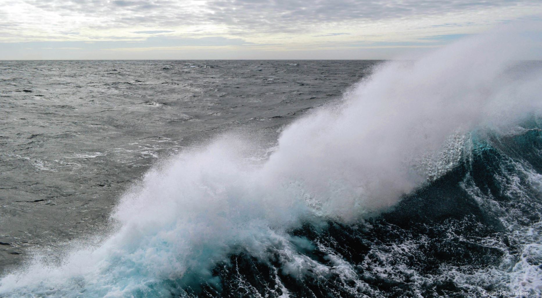
2.6 VISIBILITY, FRONT, EDDIES AND INTERNAL WAVES DETECTION
Underwater visibility has many applications, from defence purposes to mapping bottom habitat in shallow coastal waters. It is an indicator of inland water quality, responds to the impacts of invasive species and affects the retrieval of bathymetry. Satellite Derived Bathymetry (SDB) is of great interest for defence departments, private enterprises and hydrographic offices as it offers a quick and cost efficient way to chart coastal waters. From the perspective of the Canadian Hydrographic Service (CHS), the goal is not to replace current hydrographic surveys, but to complement and support them, especially in remote areas with difficult access. Traditional surveys are highly accurate, but provide inefficient coverage of shallow waters for which the risk associated with the survey is also higher, two issues solved by SDB. With a first estimate of the bathymetry on hand, a hydrographic surveyor would be aware of potential dangers to navigation before going out on the water, therefore improving safety. Additionally, SDB can also be extracted for remote and hard to reach areas like the Arctic, which is an immense challenge to survey due to its size, remoteness and climate.
Fronts and eddies are ubiquitous features in the oceans that are often associated with enhanced biological activity (e.g. Doniol-Valcroze et al., 2007, Xu et al., 2017). Depending on the generation process, they are often linked to specific bathymetric features (shelves, capes, canyons, banks, shoals, etc.). Their spatial and temporal scales vary over several orders of magnitude, ranging from small river plume boundaries (a few meters and a lifetime of a few days) to western boundary currents such as the Gulf Stream (hundreds of kilometers and coherent in time for thousands of years). As they often act as hotspots against a lower biological production background, it is therefore important to understand how fronts are generated and how they influence biological production. Remote sensing has often been used to detect and characterize fronts and eddies based on their thermal or aquatic colour signatures (McGillicuddy et al., 2001; Miller et al., 2015). Although a climatology of fronts has recently been generated for Canadian coastal waters (Cyr and Larouche, 2015; Ben Mustapha et al., 2016), work remains to be done to evaluate their temporal variability and long-term evolution with implications on local productivity.
The specular reflection of the sky radiance and/or the direct sun beam at the air-sea interface, known as sunglint, can dominate the radiance received at the top-of-atmosphere (TOA) by a space-borne sensor. Sunglint depends on the sun and sensor viewing geometry and the wave facette geometry (Cox and Munk, 1954). Recently, sunglint patterns observed in low spatial resolution (1-km) images acquired by the Moderate Resolution Imaging Spectroradiometer (MODIS) have been used to detect internal waves at the global scale (Jackson, 2007). The near nadir viewing geometry of Landsat TM makes the acquisitions during summer prone to sunglint. Evidence of solitary and non-linear internal waves in coastal waters was also found using Band 5 (1.55 - 1.75 μm) of Landsat TM at 30-m spatial resolution (Artale et al., 1990; Borzelli et al., 1994). In this spectral range, for which the water body is completely black due to extremely high absorption by pure water (593.4 m-1; Kou et al., 1993), the TOA radiance is solely due to the sum of atmospheric scattering, sky glint and sunglint contributions. Recently, Normandeau et al. (2014) detected the presence of internal waves near Pointe-des- Monts in the Gulf of St Lawrence. Internal waves have been detected in many other locations within the St Lawrence Estuary using Landsat-8 imagery (Bélanger, unpublished results).
2.7 MARINE PROTECTED AREAS AND ECOLOGICALLY AND BIOLOGICALLY SIGNIFICANT AREAS INCLUDING WETLANDS AND VEGETATED COASTAL HABITATS
Canada has lagged for many years in the designation of marine protected areas. In 2016, under the Canada-US Joint Statement on Climate, Energy and Arctic Leadership, ambitious targets have been set by the federal government to increase the proportion of coastal and marine areas conserved from the current level of 5% to 10% by 2020. Spaceborne ocean colour has already proven valuable to identify zones of high primary production, which can support a large and biodiverse ecosystem, such as areas of recurrent upwelling (Silió-Calzada et al., 2008; Nieto and Mélin, 2017). High to medium spatial resolution (10 - 300m) multispectral sensors are well adapted to provide information on the productivity of marine ecosystems in both coastal and pelagic regions. Multiple variable analyses (e.g., chlorophyll-a, SST) have been used to identify biomes or bio-geochemical provinces at global scales (Longhurst et al., 1995; Devred et al., 2007) and such approaches can be used to infer ecologically significant areas at regional and local scales (McIver et al., 2018). For coastal areas, the Landsat suite of satellites has been used to quantify kelp distribution along the western North American coasts (Cavanaugh et al., 2011) and to monitor their change with time. This type of approach could be used to delineate sensitive areas that have undergone high stress levels in recent years. These areas should be prioritized for protection.
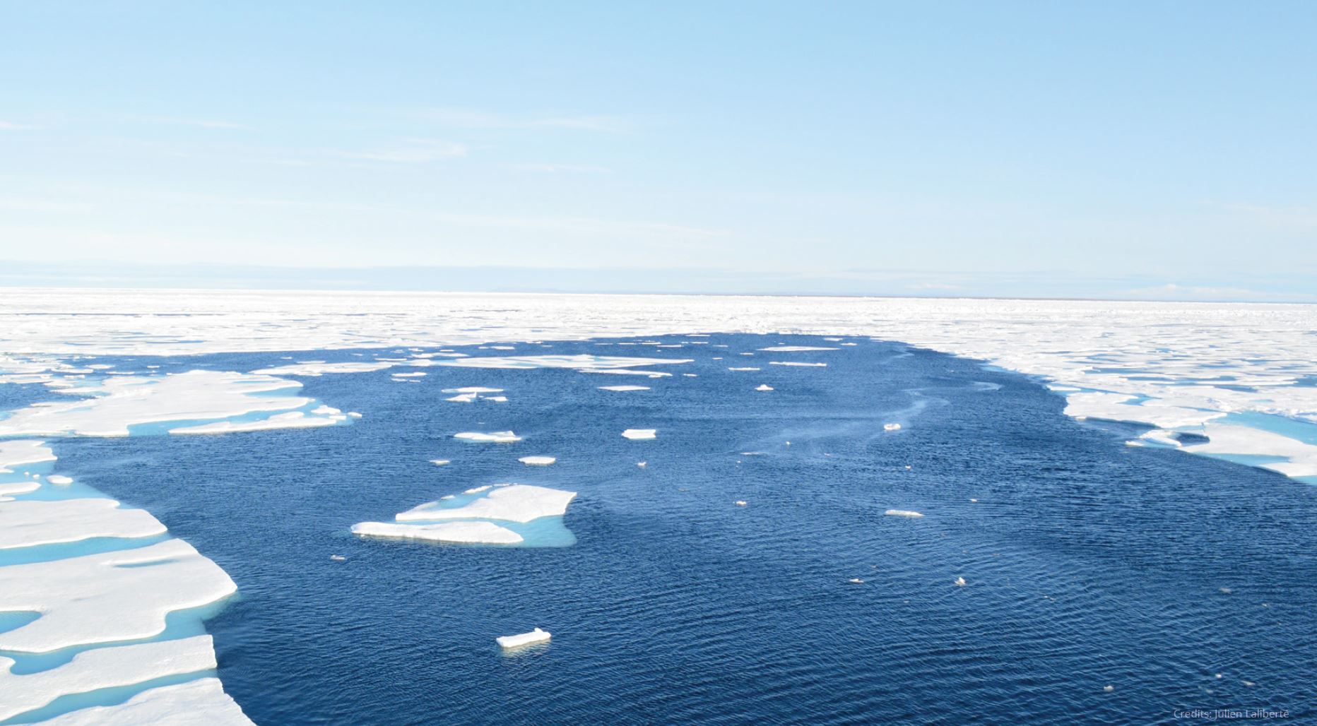
2.8 CHARACTERIZATION AND MONITORING OF SEA AND LAKE ICE
The decrease in sea- and lake-ice extent, thickness, and the loss of multi-year ice, are changing marine and freshwater ecosystems. Surdu et al. (2016) presented evidence of recent changes in the ice regime of lakes in the Canadian High Arctic, with lakes experiencing earlier dates of summer ice minimum and water-clear-of-ice (WCI); and some lakes transitioning from a perennial/multiyear to a seasonal ice regime. Microwave and RADAR technology provide detailed information on ice concentration, structure, and thickness but become limited in spring when wet snow and melt ponds form at the ice surface, thus decreasing the usefulness of microwave radiation due to liquid water absorption. Ocean colour sensors, such as MODIS, have proven valuable for retrieving the distribution of melt ponds on bare ice at coarse spatial resolution (1 km). This is an important step to understand the onset of the spring bloom, when ice-algae and under ice phytoplankton present exponential growth. In some lakes, there is evidence that intense winter algal blooms are maintained beneath the ice and may have consequences for summer hypoxia and lake responses to climate change (Twiss et al., 2012). The use of spaceborne ocean colour sensors with an improved spatial resolution (i.e., Ocean and Land Color Imager, OLCI launched on Sentinel-3A in 2016 and Sentinel 3B in 2018) will provide information on the subsequent phases of ice retreat and the development of ice edge phytoplankton blooms. Such an approach, based on the radiative budget at the top of the water column, from ice-covered to open waters, will provide a unique insight into Arctic marine eco-systems as they evolve from the very low biological activity in the winter to high production within a matter of a few weeks in the spring and summer. Spaceborne ocean colour sensors are also used to complement other spaceborne information on sea-ice concentration. Although limited by cloud cover, their high spatial resolution combined with multiple passes per day (due to their near-polar orbits) are an asset for sea-ice observation. The Canadian Ice Service (CIS), for instance, includes aquatic colour observations in addition to RADAR observations in their database.
2.9 CHANGE IN ARCTIC PRODUCTIVITY
In addition to decreasing ice cover, warming of the Arctic Ocean will have a profound impact on phytoplankton community structure, phenology, and productivity. Models estimate a summer free-of-ice Arctic Ocean by 2050 (IPCC, 2014); numerous questions remain regarding the productivity in an open Arctic Ocean. Increasing stratification may promote oligotrophic conditions and dominance of small cells in some regions of the Arctic Ocean, (Li et al., 2009) in contrast to atmospheric-induced mixing of the water column, which may trigger local productivity (large cells). Recent increases in annual primary production in the Arctic Ocean have been mainly attributed to the increase of open waters (Arrigo et al., 2015), however, the long-term impact on the marine ecosystem remains unclear. Thawing of permafrost will increase carbon export (particulate and dissolved) to the continental shelf, which in turn will change the light regime in the water column, further impacting primary production. Aquatic colour observations have played a key role in detecting changes in the Arctic Ocean at the global scale, although some challenges remain to be addressed such as how to deal with atmos-pheric corrections or adjacency effects close to the ice edge. Numerous field campaigns have been carried out by Canadian researchers in the Arctic Ocean and we can expect some of these issues to be addressed in the near future. The recent (i.e., Sentinel-3 OLCI) and future (e.g., PACE) launches of spaceborne ocean colour sensors will provide new data that will help to better forecast future primary production in the Arctic Ocean.
2.10 STATUS AND TRENDS IN INLAND WATER BIOGEOCHEMISTRY AND ECOSYSTEM HEALTH
Canada's vast network of freshwater lakes covers almost 9% of the nation's surface area, with the Great Lakes alone, the largest freshwater system on earth, containing roughly 18% of the world's fresh surface water. These freshwater systems support multiple ecosystem services; important commercial fisheries, transport, popular leisure and recreational activities, while providing drinking water, and the generation of hydroelectric power. Inland waters are under increasing pressure from physical modifications of hydrologic regimes (urbanisation and hydroelectric development), watershed land-use change (intensification of farming and fertilizer use, loss of wetland habitats), release of hazardous pollutants and nutrients, introduction of invasive species and unprecedented change from modifications to our climate. Canadian lakes are key indicators of the impact of climate change; reduced periods of lake ice have significant impacts on lake ecosystems, warming temperatures affect the timing, severity and extent of HNABs and increased frequency of storm events affect runoff and nutrient loading to lakes. While detailed assessments and monitoring of lake ecosystem health are carried out often on a lake-by-lake basis, little is known on a cross-Canada scale, and this can only be addressed using Earth observation. Advancements in sensors and algorithm development make observations of Canada's millions of small lakes increasingly reliable, which is at the basis of the NSERC Canadian Lake Pulse network.
Chapter 3 - NetCOLOR recommendations and actions
For Canada to remain an international leader in the field of spaceborne observation of lakes and oceans using multi-spectral radiometric measurements, a number of mid- and long-term objectives have to be reached. The aim of the following section is to make recommendations to managers and funding institutions. Suggested actions are presented for the aquatic visible remote sensing community to achieve these goals.
3.1 ADDRESS ISSUES RELATED TO ATMOSPHERIC CORRECTION AND ADJACENCY EFFECTS
Aquatic remote sensing reflectance, the fundamental quantity to be derived from spaceborne aquatic colour sensors, is obtained once the effects of scattering in the atmosphere (~ 90-97% of the total top-of-atmosphere signal) have been accurately modeled and removed from the observed signal. Assumptions made in the open oceans to correct for the effect of the atmosphere do not hold in coastal and inland waters. There is a critical need to achieve high accuracy of atmospheric correction, including removal of the adjacency effect in coastal and inland waters, a problem that is acute in high latitude areas close to the ice edge. With the emergence of coastal, high spatial resolution imagers, and a strong interest in information for coastal and inland environments (e.g., investment by the Canadian government in the Oceans Protection Plan), NetCOLOR recommends that this issue become a priority when addressing spaceborne observation in coastal and inland waters.
Action: Support Canadian initiatives that link to international projects addressing atmospheric correction and adjacency effects.
3.2 DEVELOPMENT OF REGIONAL, COASTAL AND INLAND ALGORITHMS AND ASSESS ADDED VALUE OF HYPERSPECTRAL DATA
There is a consensus to focus on coastal and lake waters, notably for the development of algorithms that can account for the optical complexity of these environments. Whereas it is recognised that current generic algorithms do not perform well in Canadian inland and coastal waters, there are still no regional algorithms that have been demonstrated to perform well in domestic waters. Emergence of new hyperspectral capacities, such as PACE and possibly the Dual Imaging Spectrometer COCI Experiment (DICE) system, raises the need to thoroughly as-sess the improvement of such sensors over those that supply multispectral data. There is a need to define optimum spatial and spectral resolutions to address issues specific to highly dynamic inland and coastal environments.
Action: Create a working group on algorithm development and validation, including hyper-spectral approaches for Canadian waters, including the Arctic Ocean. This working group would focus on the development of regional algorithms and conduct a systematic validation in Canadian waters. Support should be sought to carry out these activities.
3.3 SYNERGY WITH OTHER PLATFORMS AND TECHNOLOGIES AND CONTINUITY OF SPACEBORNE OCEAN COLOUR DATA
One of the main limitations of ocean colour sensors is that they cannot collect data under conditions of cloud cover, sea-ice, or during the night. To increase data coverage, we recommend developing synergies between spaceborne aquatic colour data and consolidating regional inter-calibrated and merged datasets from various sensors, such as the ESA-Climate Change Initiative (CCI) or the GlobColour approaches for the global scale, which utilise data archives from the MERIS, Aqua-MODIS, SeaWiFS, and VIIRS missions to ensure an uninterrupted time series of multi-sensor spaceborne global data products for climate research and modelling. In addition, synergy between various platforms should be attempted, not only for inland and coastal waters, but also in offshore waters. Canada will launch the RADARSAT Constellation Mission (RCM) in 2020 and is involved in the Surface Water Ocean Topography (SWOT) mission, which could create opportunities for synergies between missions. NetCOLOR also recommends developing synergies between in situ instruments (e.g., gliders, Bio-Argo floats, and moorings) for both validation and monitoring activities, since coupling these observational means would provide a three dimensional view of the ocean, adding a vertical dimension that is not possible with current spaceborne sensors.
Action: With CSA support, initiate projects on long term OCR data continuity and synergy between aquatic colour, RADAR, and altimetry technologies for sea-ice related research and mapping and monitoring of coastal habitats.
3.4 DATA MINING AND ARCHIVING
Large in situ bio-geo-optical datasets have been, and are currently, collected by Canadian scientists. NetCOLOR recommends urgent action to invest in data mining, quality control, and archiving of historic in situ datasets collected by Canadian PIs to support spaceborne data product validation, algorithm development, and other analyses. There is a need for a national repository that will be searchable and can provide relevant data to researchers in an advanced format, for example, using the format guidelines for the NASA SeaBASS or ESA MERMAID bio-optical data archive. SeaBASS data and files can be accessed and saved using a series of online search engines, e.g., the user can extract files for different variables to perform matchups.
Action: Under NetCOLOR's supervision, and together with financial support from various Canadian institutions, hire a technician or contract the private sector to develop a database that is accessible to Canadian members of the NetCOLOR community with the possibility to query. Open an international database in agreement with intellectual property policy.
3.5 CONSOLIDATING THE COMMUNITY, TRAINING OF THE NEXT GENERATION AND OUTREACH
Canadian researchers have made a strong contribution to international advances in the theory and application of bio-optics to spaceborne remote sensing for monitoring our marine and freshwater environments. For Canada to pursue its leading role at an international level there is a strong need to prepare the next generation of scientists in various fields of visible radiometry, from field operations to spaceborne data processing and the development of new algorithms. Simultaneously, we recommend a strong effort to maintain the cohesion of the community, through increased collaboration and regular meetings. In this respect, NetCOLOR can become a key player in achieving this objective. Applications of spaceborne aquatic colour radiometry have far reaching possibilities that trigger interest from a diverse community from fish stock assessment, to bathymetry information in coastal waters and water quality in coastal areas and inland lakes. We recommend fostering and strengthening exchange and collaboration between our community and end-users through targeted events, such as inviting end-users to NetCOLOR meetings and actively promoting the technology to managers and decision-makers, etc.
Action: Organise a training course under the NetCOLOR umbrella, as was previously done in 2006 (organised by IOCCG under CSA funding) targeting end-users and young researchers.
Canada has the human resources, technology, and know-how to address the challenges of Earth Observation and can help solve issues related to the marine and freshwater environments. By creating a network of experts in the field of aquatic bio-optics, our community aims to structure its activities, creating opportunities and collaborations, while directing outreach and applications towards end-users (including scientists from other disciplines, managers, and decision makers), and preparing the next generation of scientists. NetCOLOR also strives to increase visibility and achieve consensus when dealing with funding institutions and partners for the benefit of our entire community. The present document illustrates the results of such a collaboration where the views of individuals are confronted and debated to reach an overall agreement on issues such as the pressing questions that aquatic colour remote sensing can help tackle.
For the annexes and the references, see the report here :
Report on Canadian Priorities